It was 10pm on Sunday night as I zipped up my rain gear. To the northwest, a storm grew and lightning struck in the distance.
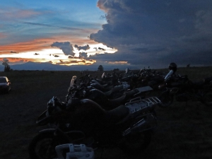
(For many reasons, I don’t have pictures of the stormy ride home, so these are shots I took from Rawhyde’s Colorado base.)
It had been an exhausting weekend, but with the knowledge I learned and the thought of sleeping in my own bed with my wife, gave me the energy to ride the 3 hours home.
Raindrops hit my visor and windscreen and I started my bike and turned off the ABS. I had become a pro at turning it off, and skilled at riding off-road. Even today we took a fun ride through the slickest mud I’ve seen since my first epic fall in the mud trying to complete the southern Colorado section of the Great Divide Trail.
If you peruse my past ride reports here (at least those on two wheels), you will see the recurring theme is of me falling, or trying not to fall, and for quite a few years now I’ve been lamenting not being able to take a class that would teach me how to ride my GS off-road.
Sure I’ve known of the Rawhyde classes, but I wasn’t going to travel all the way to California to enroll. I simply didn’t have that kind of time or cash. But when they opened up shop here in Colorado I had no excuse but to save my pennies. I even thought of the class as a way to save money from not buying all the parts I might break on my bike in the myriad of falls I take (this is still only a hypothesis, so don’t quote me on that!) Plus, I want to upgrade to the 800 GS soon, so getting some skills and confidence are high on my list of “upgrades” I’d like with a new bike.
I kicked my 650 into first gear, revving the engine and slipping the clutch. Since I spent the entire weekend without loaded down panniers, the bike responded sluggishly and I had to add more throttle. I crunched out over gravel, rode through the gate and into the darkness.
Naturally the rain started right up. Big drops indicated towering cumulus clouds above. I switched between high and low beams, wishing I had an auxiliary light. But I kept the speed slow and my upper body loose as I stood on the pegs, taking the turns back to the main county road.
When I got to Country Road 53, the rain came down steadily and since I stood, it ran down into my gloves. I flipped on my heated grips and kept riding. What else could you do? The smartest thing would’ve been to stay the night.
Lightning flashed in the distance, briefly illuminating the landscape and reminding me of the storm scene in All the Pretty Horses. A rabbit, caught in the side beam of my headlight raced toward my front tire only to veer away at the last moment. Way too quick do one of the panic stops we learned that day.
I kept riding. More lightning, more rain in my gloves, and more miles passed below me. The road varied between washboard gravel, hard packed mud and just slick sections with puddles, but my training served me well. Every once in a mile there was a wobble and a slight meandering of the bike, but I stayed upright and didn’t worry, even smiling at some of the small challenges that cropped up.
Once I hit the highway, I turned the ABS back on, and lit out for home. The rain had stopped and eventually the roads would dry out. I crawled into bed after midnight and even now as I write this, I am looking forward to my next off-road adventure. Maybe the road to Moffat Tunnel. Now I just have to find the time.
It had been a short but packed weekend, but that final ride in the rain felt like my graduation test. And I feel I passed with flying colors.
“If we’re riding on the BDR tomorrow, we’re getting up at five,” Dezso said, sounding petty adamant.
I had another friend on another road trip so very long ago that was also adamant that we get up at five. He said he’d even start off driving so everyone could still sleep. And sure enough he’d get us all up, hop in the driver’s seat and thirty minutes later ask someone else to drive because he was tired and wanted to nap.
They never did find his body.
“No way! Seven”
“Six, “ Dezso countered, “and we’re getting up and getting on the road. We’ll stop for coffee later.”
“But there’s free coffee and breakfast downstairs!”
So we settled on 6 and free coffee, not even realizing that in a few short hours we’d pass into Arizona which doesn’t believe in Daylight Savings Time, thus gaining another hour to ride. It was my turn to panic. My odometer showed two hundred miles and I figured I had about seventy miles left. Dezso said he still had half a tank and we both know my single cylinder 650 gets way better gas mileage than his. So once the morning fog cleared out of my brain, I figured I hadn’t zero’d out my trip counter from the last fill up.
Our first stop was the Painted Desert and Petrified Forest national parks. Last year I had purchased a national parks pass and shared it with Dezso, so he did the same this year and I got in for free. I haven’t been here in decades. I remember having gone here on a family vacation, but I can’t really tell you how much it’s changed over the years. I’m pretty sure the adamant tone regarding not collecting things in the park and the search stations at the exits are a more recent addition. But if you really need a chunk of petrified wood there are a million shops right outside the park.
I was surprised to see a lot of desert flora in the area (duh).
I guess I didn’t know what to expect but grasses and brush grew in the area.
We pulled in to each turn out, sometimes getting off the bike for photos and sometimes just standing on the pegs to get a look out over the edge.
We were both suitably impressed with the park, and I’ve love to see it from the air as the maps show a large swath of geography that “looks like tye dye” covering a good chunk of the area. From the ground, there are lots of colors although none looking like an old weathered hippie.
The landscape range in colors from faded desert tans to reds and purples. It almost reminded me of the colors of Petra, Jordan. Most of the overlooks (by definition) looked out over the landscape from the top of buttes, but there were a couple at ground level that looked up onto hills (named the Tepees) which gave a different perspective.
Just before we crossed over I-40, there’s a pullout for Historic Route 66.
Jack Kerouac traveled this often, so it always holds a little place in my heart. Pair that with my love of maps and travel and I’m hooked. I want to have the time (and money) to travel its length on my Ural.
To be fair, I would also like to travel Rte 66 in a car like this.
We took a side road leading to Newspaper Rock. I assumed a place where people came to sign their names in the soft rock (there’s a place like that out…somewhere. Montana? I’ve forgotten where because I think I’ve seen a couple of them. One in Montana where Lewis and Clark signed their names and one in Nebraska or Kansas.) This one had Native American Petroglyphs instead. You could stand on a platform and use scopes to look down on a couple of large boulders that had been covered in glyphs.
Soon we started seeing chunks of petrified trees. Dark brown chunks of rock laying on the distant landscape. Since we rode from north to south, it took a while to hit the more grand chunks of forest and they saved the grand finale for last.
At the Petrified Forest Museum they have a park you can walk around in. Some have the upper formations of roots, some are really large in diameter, but they’re all just gorgeous to look at.
Crystals mixed darker minerals, all showing tree rings. It really is amazing to see and I highly recommend a stop if you’re passing through.
We stopped at almost every pullout and it only took us an hour. There’s building labeled as an inn inside the park, but it only functions as a museum. All I can think of are the millions of stars over this stark landscape that would make for some amazing photographs (provided you know what you’re doing). Oh well, another vague plan thwarted.
The wind picked up and as we rode into Holbrook, we got hit with some significant gusts that had us leaned far into the wind and weaving in our lane. We stopped for lunch at a mom and pop Mexican American restaurant that hovered right around mediocre. We jumped back on the road and headed into Heber. We were still bucking a strong crosswind which didn’t stop until we got into a landscape with a few more trees.
The landscape started off with a windswept prairie that graduated to pinions which eventually changed to a pine forest. The temperature dropped and clouds built up. Mom wrote and said it was overcast in Prescott and so we might get some rain. Not a good sign since we still hadn’t started riding where the pavement ended.
Why’s it always gotta rain when I want to ride off road?
Just west of Heber we picked up the AZ BDR on Rte 300. This is a section that follows the Mogollon Rim. We had climbed about 2000 feet in elevation, so we had to pull over and don some warmer layers. Just then the drizzle started and we watched the side roads to see what they ground would be like once we hit dirt. Since we’ve never ridden off-road here, we weren’t sure what the ground would be like (mud, gravel, quicksand) and since I’ve already taken a good spill in the mud, I wasn’t too keen on repeating the maneuver.
Fortunately (or un) Rte 300 was paved for a while. We stopped for a photo-op looking out from the Mogollon Rim and could see the wall of rain approaching. Still optimistic we continued on. Eventually the pavement ended, turned to eroded pavement, then gravel, and finally hard packed dirt which slowly turned to mud in the rain.
We turned around based on my “recommendation.”
On the plus side it knocked a couple of hours off of our trip.
We back-tracked a mile or two and rejoined Hwy 260 and rode into the Verde Valley. As we descended in elevation and the rain stopped we had to take off more and more layers until we were sweating in our Kevlar. We passed quickly through Cottonwood, and started our climb into Jerome.
Yeah, this is Arizona, so it is best to leave people alone.
Jerome is a fun little town with a motto of “We’re all here because we’re not all there.” It used to be an old mining town and is the home of Caduceus Cellars, expensive wine made by the front man of the band Tool and Puscifer. I would normally scoff at such a wine, and I did so until I tried it on a previous trip. In fact wines from this area are pleasant and I’ll usually buy a bottle for special occasions (like the one I’m saving for when I finish my second novel) or friends who’ll cook me a nice meal. But paying $40 for a bottle of wine is something I’ll rarely do. There are too many great bottles under $20 that are just as, if not more, enjoyable.
(Looking toward Sedona)
Since I still had a fair amount riding left to do today, and had been riding for two days straight and was tired, I just popped in and purchased two bottles of wine I had previously enjoyed without doing a tasting. Now it was the final stretch into Prescott. We were tired and saddle sore and Mom had mentioned dinner at a deli near the house. I was sad that I didn’t get a chance to ride off-road, but we’ve got the Rawhyde class and Colorado BDR coming up in a month. Stay tuned for more reports!
Yeah, I bet that title has never been used before.
This was the first real ride of the season and I was anxious to stretch the legs of the proverbial pistons in my F 650 GS. Dezso had started out a couple of days before me as I still had work left to do. He departed from Cortez as I left from home with an expectation to meet in Montrose for a late lunch.
My route took me over Monarch Pass on US 50 which I don’t remember having done on the GS before (I’ll have to consult my maps). Weather was near perfect and I started out to partly cloudy skies and 60 degree temps. Leaving the house after rush hour let me leap onto the highway and ride at highway speeds on C470, getting me into the mountains a whole lot quicker than normal.
I didn’t stop until Monarch Pass for a photo op. Out to the west I could see storm clouds building and dumping. I tried to consult weather maps on my phone, but was surprised to learn I had no cell coverage on top of Monarch. Well, it wasn’t like I could take an alternate route to Montrose anyway.
I gassed up in Gunnison, sending texts to Deana and Dezso and letting them know my status. The clouds continued to build, but they appeared to move southward and in the end I stayed dry. Dezso was already waiting for me at Don Gilberto’s Mexican restaurant and a storm built up just to the west of town. We expected rain and got a few drops as we rode out, but the storm also moved south and we ended up chasing it to Ridgeway.
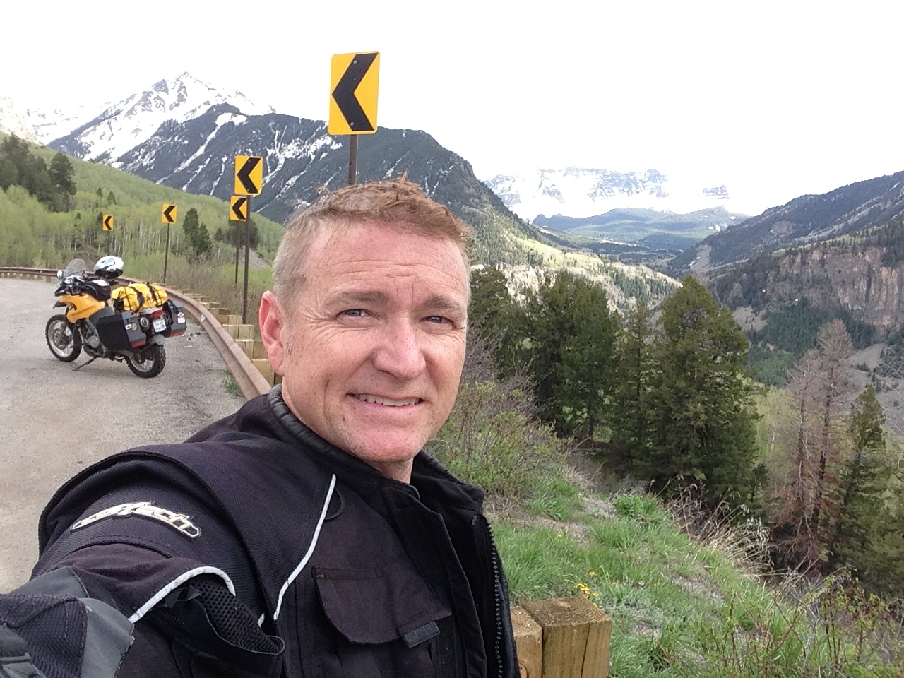
I had this plan to ride over Ophir Pass near Telluride as a little off road practice. From Ridgeway I had wanted to stay on US550 to catch Ophir Pass, but construction had closed the highway down until 6:30 that night and that storm looked ugly from where we sat.
Instead we turned west on HWY 62 toward Telluride. Outside of Ridgeway Dezso realized he had needed to gas up. But neither of us really wanted to turn around and a quick consultation of my mental map reminded me of a gas station outside of Telluride where we could stop.
We finally hit rain on our way into Telluride, which ruled out any chance of attempting Ophir Pass from this side. So we pressed forward on pavement.
Near Lizard Head Pass the off-and-on drizzle finally left us and we dried out quickly.
Hwy 145 is a nice winding road that takes you from mountain passes and aspens, down into the high desert lands in the Four Corners region.
Dezso had camped at Mesa Verde the previous night (turns out the campground has wifi), and since I’ve been there many times including mapping, I didn’t feel the need to stop in again.
In Cortez we had to make a decision. Since we couldn’t attempt any off road riding here in Colorado, we decided to ride part of the Arizona BDR tomorrow. With that in mind, we decided to push on to Gallup. We had every intention of camping (honest!), but we traveled through Native American reservations and there aren’t any opportunities for camping. Dezso even went so far as to ask in Shiprock, NM. But the woman shook her head and said, “You don’t want to camp here.” I got online and booked a hotel room in Gallup.
We rode the remaining part of the ride in the dark, switching to mp3 players to pass the time. Despite the rain spoiling our off road ride, it was a good day back in the saddle. And since there was no dirt, at least I wasn’t falling down. (Dezso and I signed up for the Rawhyde off road course in Colorado in July, so we’ll see how much that’ll help my riding.)
We ended up just off of US-191 on the north side of town, easily marked by all the other trucks and trailers parked on the side of the road. The dogs were still exhausted, so Michael and Rachel decided to stay in their Landcruiser and follow along behind (Sadly they had to turn back since the bouncing shook the exhausted dogs too much).
We off-loaded the bikes and two ATVs and headed up a maintained dirt road that took us to a nice overlook and then into the back country of the Mill Canyon area. The women who checked us out at the rental shop told us that there are dinosaur fossils and a natural arch (Tusher Tunnel) that we could ride to and I was quite interested to see these things.
The OHV trail quickly took us to slick rock and sandy areas, giving me the opportunity to take the comfort I gained in the morning and apply it with the skills I remembered from my class. Soon enough I was dipping up and over bare rock, rock outcroppings, and bits of sand and silt.
Deana also gained confidence with her ATV and started to learn her way around and over the bumps and dips in the road.
I have to say it was nice having the ATVs with us since they had luggage racks and we could store what we need on them, leaving the dirt bikes light and unencumbered—which would turn out beneficial once we hit the deep sand.
When we made it to the top of the plateau, the rocks went away and the sand became the larger part of the track. Deana loved this since it gave her a smoother ride, but it is also where I had to slow down.
Fortunately, Alex and Deana waited patiently while Dezso and I conferred about how to tackle the sand. Training had taught me (and it was hard to do at times) to stand on the pegs (lower center of gravity) , knees hugging the gas tank, and bend over the bars so that you’re neither tugging on them or leaning all of your upper body on them.
And if Deana and I felt more comfortable on our machines, Dezso zipped up and down and back and forth, always in the lead and soon enough reporting back when there was a sand trap up ahead.
I think he enjoyed the high sand berms and we occasionally caught sight of him with a rooster tail of sand kicking out behind his bike. (And now that we’re back home, he’s sent me some photos and links of dirt bikes for sale. Pure evil, I tell ya! Pure evil.)
And it was about this time that I took a spill. Of course I had to do it right in front of my wife but hey, that’s what humility is all about, right?
We came up to a large section of sand. Dezso had stopped and warned me about it and we talked about how to approach it. The trick is that you need to allow the bike to go its own way through the sand. But the problem that arose for me is that my bike continually wanted to creep off the trail and into the sage brush.
Like a horse trying to brush off its rider, my bike and I scraped sage before sinking back into the track. The rear tire would swing out and then up the slight berm I would go, scraping brush again. I wove over to the other side and repeated this process before finding a deeper section of sand and dumping over.
The bike lay half buried in the sand, making it hard to get a grip and prop it upright. Alex came over and together we got it up. I do know that if I had been on my GS and loaded down with camping gear, I would’ve just put a for sale sign on the bike right there.
Of course, having said that, I am also interested to come out here, set up camp, and then remove the mirrors and Jesse bags (they really don’t need to see any more damage) and go to one of these sand tracks and try to ride. I think what I need to do is practice until I know what the bike is going to do and what I need to do in order to remain upright. I can’t imagine how those people racing in the Dakar can do it at the speeds they’re traveling at. I can’t even get out of second gear!
We had a few more miles of sand. Some of it deep, some shallow, and some back to dirt and rocks. It really started to wear me out!
We made it to the turn off for the natural arch. It lay an undetermined length ahead of us and the trail looked like nothing but sand.
Dezso was getting knackered, but the rest of us still wanted to see it, so we had Deana ride up to the top of the hill (nothing but sand on that hill) and report back using our headsets. She said it looked fine. Once the ATVs made it up, Dezso took his turn, staying on the right track.
The sand looked deeper on that side and he kicked up quite the screen of sand as the bike dug in. Just at the top he went over. As he and Alex pushed his bike upright, I took the left track where it looked a little easier and my gamble paid off.
But as we looked over the hill at the rest of the track we saw nothing but sand. It was late. We were hot and tired and decided to turn back. We’ll save Tusher Tunnel for our next trip out. There are lots of trails and side trails to explore in this area and since we all had a great time, we’re already planning a trip in the Fall once things cool down again.
It’s already March and both Dezso and I have been champing at the bit to get out on some rides. It has been a long winter with very little riding, not even when I could take the Ural out in the snow. Work and everything else seems to have blown up in my face and kept me out of my garage and neglecting my bikes.
So when Dezso proposed a trip to Moab to rent dirt bikes, I was all for it. I had taken a dirt bike class, using Honda 230s in a vain attempt to help me ride my GS through dirt, sand, and gravel. Sadly, only dirt had been present at my class, but I did get a better feel for riding a small bike off-road.
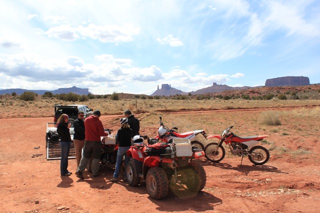
We invited some friends, Dezso’s brother, Alex, and my wife, Deana, who were interested in renting ATVs, and struck out for the weekend, camping along Highway 128 and eating at Fiesta Mexicana like we usually do. In the morning, after a breakfast of habanero bacon, eggs, and coffee, we headed to High Point to rent a slew of machines.
The crew at High Point Hummer and ATV were friendly and charming, but as they went over the machines with us, noting every scratch, ding, and dent, we all became worried that we’d have to account for everything that touched the bikes and ATVs, including our butts. But that wasn’t the case, as they took our machines back with smiles. (Not that we tore the living shit out of those machines, but I’m sure it’s every rental agency’s worry that they won’t see their cash flow return, and it’s the customer’s worry that they’ll find something that only can be seen with the aid of a microscope)
Photo Courtesy of Rachel
Since only one dirt bike (A new Honda 250) was street legal, we had to rent a trailer as well ( Which actually comes free with the rental as do coolers and a gas can). I rode the Honda 250 up to Onion Creek/ Fischer’s Tower and Dezso towed the rest with his truck. Dezso and I had ridden this road last year as part of the Utah Backcountry Discovery Route and I had wished I had been able to take photos, but also wished I could’ve shown the area to Deana. Now I finally got the chance.
I had tried to sync our three helmets (Deana, Dezso and me), but couldn’t quite figure it out. Plus we were all ready to hit the trails, so talking to Deana trumps Dezso in this situation.
It wouldn’t have mattered; we unloaded the machines and Dezso immediately took off only to be spotted when he returned to see where we were.
Michael and Rachel brought up the rear as they had their two dogs with them, but the poor dogs lasted about 3 stream crossings before tiring out and they had to return to the car to let the dogs sleep it off. I stuck with Deana as she got the feel for her ATV and I got the feel for my Honda 230.
This improved road follows Onion Creek and crosses it many times. For once I had on waterproof boots and had no qualms about splashing through each time. On such a small bike, I had no problem bouncing over hidden rocks in the stream bed, or going a little faster around turns, using the techniques I had learned in my class.
The red canyon walls crept closer and taller as we wound our way through. There were other ATVs, dirk bikes, and cars on the road. Vehicles had parked all along and off the roadway, enjoying an overcast and slightly chilly day. The road dipped and turned, giving Deana the opportunity to practice shifting as well as turning while using the thumb accelerator on her ATV.
Gradually the road led up a few switchbacks and put us (sort of) on top of things. We had the option of continuing on, or returning to the truck and trying another off-road trail. It was a unanimous consensus and we turned around. There was more to see out there.
On the way down, we met up with Michael and Rachel who had dumped the dogs in the car to rest and sped along to catch up with us. We told them our plan and they were fine with it. By now we rarely saw Dezso who zipped along like a Labrador Retriever chasing balls.
We made it back to the trailer and opened our coolers for meats and cheeses and crackers before trailering over to the next area.
For once I got to have a lazy Saturday morning before our trip, as we would ride only as far south as Santa Fe to stay with some friends. Dezso showed up around 1 and with loaded bikes we took off down I-25, wanting to make good time.
Near Walsenburg, Dezso said his Scala rider intercom system had come off, the sticker portion having finally worn away.
We pulled off at a no name exit and made it secure with a little JB Weld. It held for good.
The rest of the ride to Santa Fe was uneventful aside from a deer that ran out in front of Dezso around dusk. We stopped for a 6-pack, then zipped over to our host’s place for a dinner that awaited us. Best meal of the trip.
I had agreed to wake up early on this trip, due to concern about afternoon thunderstorms bogging us down. I struggled awake at 6:30 each morning, groping for coffee until my mind was relatively clear.
(My vice. I’ll always stop at Whataburger.)
We loaded up and talked about dual sport riding and our Beemers with Dave and Faith, noticing the same glimmer in their eyes that I had before I bought mine. Sure enough, not even an hour down the road, Dave had emailed that they were looking at GSs in their area. They are not strangers to motorcycles, having ridden Harleys since their teens. Dave has always been a font of information to help me when I’m ready to pull out the Emergency Roadside Dynamite (patent pending) for a more permanent solution to something I can’t figure out. But I believe this was the first time they’ve been tempted by dual sport riding.
South of Albuquerque things (yes things) crawled across the road. I thought they were tarantulas as something in my brain remembered something about those hairy little monsters being prevalent down here. I mentioned it to Dezso who rode for about 50 miles with his feet on his handlebars (in full disclosure, I’m even worse when it comes to snakes. I just hate those little bastards). At some point we realized they weren’t hairy, crawling death, but monster sized grasshoppers (locusts? I don’t know,)
We passed through Hatch, NM and could smell the roasting chiles in the air. Each restaurant featured red or green chiles on their store front, and I wished I could’ve picked up some for the trip. We pushed on, passing a border patrol checkpoint before fueling up in Deming.
As we filled up a red mustang with Minnesota plates pulled in too. The driver got out and asked me what that checkpoint was all about, which kinda amused me. There’s quite a different border up north.
We made it to Segar and jumped on the Great Divide Trail. Light gravel made it easy for Dezso to zip off in front, but it had been awhile since I had been on anything other than pavement and I took it slower, still remembering the highlights reel of my greatest slips and spills.
I still put Dezso in the lead when it comes to off-road riding as I like the warnings of what’s to come. In the washes and gullies, the sand was thick and deep, so we both took it slow in these areas, speeding up for stretches of road that were on high ground.
In a surprising turn of events, Dezso was the first to go down. He made it through deep sand in a dry creek bed, but his balance got thrown off bumping up the other side. Two wobbles later and he went down, somehow getting his pants leg stuck on his pannier and giving it a good whack. I rode over slowly and made it without falling before helping Dezso pick his bike up. He limped around on his leg, trying to work out the pain. Nothing felt broken and no ligaments seemed torn, so he’d probably just end up with some bruising.
A few more turns, and we got to the next sandy creek bottom, this time with river cobbles as well. Dezso made it through, and I took a spill, pinning my ankle under my pannier (I am SERIOUSLY thinking about getting soft bags!). You know the calcaneus?
Yeah, that was the contact point with the pannier.
“Dude,” Dezso said. “Did you just face plant?”
“Yeah, and I can’t get up. I’m pinned under the bike. Come help me.” I was face down and couldn’t twist around to lift the bike off of me. I tried using my free foot to dig out from around my pinned foot, but it didn’t work as I intended.
I bet we made a funny sight: me, face down kissing America, and Dezso hobbling over as fast as he could to help get me out from under the bike. Me, cursing in pain because of the pannier, and him cursing in pain because of the weight he put on his leg.
Once again, we got the bike off of my ankle and onto its kickstand to assess the damage. The mirror had twisted loose and once again, battery acid leaked out—I really hate this function of my 2001 F650 GS: the open cell battery. As many times as I fall over, there’s always battery acid leaking out, and from what I’ve been told, I can’t put a closed cell battery in! (Someone who has one please tell me I’m wrong.)
We rode for a little while longer, stopping for Dezso to walk out his leg and to take some photos. I looked down and noticed my handlebar weight was now missing. I guess the drop had loosened it enough to vibrate off. And where my hand rests on the grip and my arm angles up, I couldn’t have seen it drop off anyway. I rode back for about a mile to look for it, but I couldn’t find it.
(Never seen anyone actually put the “no pants” part of this sign. I wonder if they actually had people come in sans pants.)
We rode into Silver City, NM and stopped at a gas station. A truck blasted Tejano music which put Dezso in the mood for Mexican food. (To be fair, the wind changing direction could put Dezso in the mood for Mexican food.) I got on Yelp and found a few places, but as we rode around town from one restaurant to the next, it became clear that this town shuts down on Sundays. We ended up at a bar and grill on the main highway with fairly tasty food and a cute bartendress to boot. We got a hotel room so Dezso could ice his leg and we could decide if we’d hit the trails or go to the ER in the morning.
There’s a point in the morning where the sound of drizzle hitting your tent no longer matters because your air mattress had lost 90% of its air and you are essentially resting on the ground. Does one get off the uncomfortable but dry floor of the tent, or get up and go outside to face the damp day? At least there’s coffee to look forward to.
While watching the weather on our phones, we loaded up, and rode into town for gas. Dezso expressed an interest in heading out to the Twin Lakes for some photos so we altered our plans to include a side ride.
The rain continued to pick up and by the time we reached the turn for Hwy 82, my engine had lost significant power. My speed went from 60 on the downhill to 40 and I had to downshift to keep it at that speed.
We pulled into a parking area near the lake and tried to troubleshoot the issue.
This was the first time I’ve had such a problem and I wondered if it might be bad gas or water in my carbs (turns out that due to the day and night of wet weather, then riding out in the worst of it, my coil and plugs had gotten wet-but I didn’t know this at the time). We didn’t have many options: We could head south on US 24 to Buena Vista, then head up US 285 to home, or head up and over Weston Pass to US 285 and head home. The former route would be more populated in case I broke down, and the latter, would be in a harder to reach place, but I wouldn’t have to worry about any speeders rear-ending me for going too slow in the rain.
Cell coverage wouldn’t be great, and Dezso was concerned about riding through mud on two wheels. But with these power issues I felt it best to take Weston Pass. I lead the charge, linking our intercoms so I could warn him as to when any mud or soft sand leapt out from the road in an attempt to sabotage his ride.
And to Dezso’s credit, he didn’t seem to have any trouble—which kinda pisses me off. Why can’t I have that kind of skill on my GS? I am forever slipping and falling over—sometimes even when I come to a complete stop!
The road comprised mostly of larger rocks sticking out of sand. There were little bits of mud, but Dezso didn’t have any problems.
I had problems on the more bouncy portions of the road and there were times when we all got off the Ural and pushed it up to the next flat area. I think I’m due for the new and improved clutch.
The clouds parted near the summit and we had a good time getting to Fairplay, enjoying the sudden lack of rain.
Getting to the top: A reenactment of how we did it.
To the west we could see storms descending off the mountains as they dumped on the continental divide. We gassed up and suddenly my engine ran better—sometimes even reaching 65 mph which also led me to believe it had been bad gas (but when I got home, I checked with a variety of people and forums and the consensus was that it had been the rain that caused the problem).
We rode up to Bailey and stopped for a late lunch, hoping to dodge some of the worst weather. The rain caught up, then passed us as we lingered over fries and cokes. By the time we got outside it only sprinkled.
There wasn’t much more rain and we mostly dried out on our way home. As with all Sundays in Colorado, we did get stuck in traffic as Denver returned home in preparation for the Monday work day.
Overall, the trip was a success. The air mattress was a nice addition, but we knew going in that it was on its way out. The next time we get stuck in that much rain, I think I will suck it up and get a hotel room, just so our stuff stays dry. I will also spray my coil with WD-40 to keep the moisture off, and with a new and improved clutch plate I will be ready to tackle the larger passes on the COBDR. I can’t wait till next year!
We first awoke at 4am, courtesy of some large diesel truck rumbling through the park. We had no idea what he sought, but it certainly was annoying. I lingered awake only long enough to pull my keffiyeh over my head for the extra warmth.
The next time we awoke, it was dawn, but the sun hadn’t hit our tent, and the air was still chilly. Since this was vacation, we rolled over again until a “reasonable hour” had been reached, i.e. when the sun had warmed things up.
We had a quick meal of coffee and granola bars before loading up and getting back on the BDR. We passed a sign that said Steamboat Springs was only 29 miles away. I had plenty of gas, having filled up from the jerry can. What I didn’t realize is that the BDR takes a few turns before reaching Steamboat, taking to all points west and possibly even close to the Pacific Ocean.
Deana spotted a side trail off to our right and wondered aloud about where it went. I turned around to find out. The path went up a slight hill before ending at a campsite. Cross beams lashed to trees indicated it must’ve been used for hunting, and the fire pit was large enough to warm quite a party, but the best part Deana spotted first.
“There’s an office chair over there.”
“What?” I asked and pulled over. Sure enough an office chair sat sublimely in a sunbeam beneath the aspens. We took a few photos before returning to the BDR.
We passed through the town of Columbine, stopping to read a plaque telling the story of a mine there and how the owner of that mine chased his wife with a butcher knife to the town because “The voices in his head told him that her ghost would lead him to the gold.”
15 minutes later we rode past Steamboat Lake State Park. Okay, so we hadn’t been that far when we stopped for the night, but judging by the crowds, we did alright camping in the national forest. Houses dotted the fields around us as we twisted and turned in a direction that always seemed to be away from Steamboat Springs. Some houses looked like summer homes, and others looked lived in year round. Regardless, many had For Sale signs on them.
Two hundred more turns and we rode past an elk farm (I wonder if they’d sell you a steak right before you camped for the night? If so, that’d be my plan for the next time down the BDR). Then there was farm and ranch land, and then—holy shit—the Valley of the Grasshoppers. I’m not talking about a few skipping merrily across the road. They jumped and flew everywhere—into the hack, all over Deana and me, our luggage, and yes, they even wedged themselves into the cooling fins on the cylinder heads.
Deana set about removing the ones from the sidecar, no longer leaning in the turns because the little hoppers seemed to aim directly for her helmet (another great reason for ATGATT. I’d hate to see what would happen should one of those little buggers hop their way up your sleeve and commenced to bounce around your armpit!) Hazards like this should be marked on the map!
What felt like 28 days later we pulled up in Steamboat for gas and Deana continued to evict grasshoppers from our rig where birds made quick work of those that didn’t get away fast enough. As we were leaving, we got a text from Dezso.
“I know it’s short notice, but I’m going for a ride. Want to come?”
“We’re already on the BDR. Ride to Gypsum, then head north. We’ll meet you along the way.”
We continued south on paved roads until we reached the end of pavement marked by a sign that read “Impassable when wet.” Being on the Ural, I liked that! But as there were no rain clouds in the sky (yet) we couldn’t test that theory. As we rode down this road, I could guess at the meaning of the sign. From side to side, the road opened up in varying sizes of potholes. Fill those up with water and you just might have some hazards.
We passed some cyclists, then some hikers and fishermen. Apparently this was a popular trail. When we stopped for some photos we noticed a roasting smell. It wasn’t quite bbq, but it wasn’t quite hamburgers grilling either. It turned out to be all the grasshoppers stuck in the cooling fins. I grabbed a stick and proceeded to flick out as many as I could reach.
We passed Stagecoach State Park, not having realized there was such a large body of water up here. A couple of boats and jet skis dotted the water and it looked quite pleasant. We rode around the lake, hitting some pavement and some dirt roads.
Now it started to look like rain. Dark clouds rolled past and we hoped we’d dodge the worst of it. I debated rain gear, but just ended up pulling on my jacket. Lightening cracked overhead and it started to drizzle as we rode through more ranch land. Aspen covered slopes stretched up on our left, and pastures with a stream meandering through opened up on our right. It was definitely gorgeous up here.
We passed a few trailheads and a semi rest area with bathrooms and an informative moose sign so we stopped for a coke and trail mix whilst we read the sign. Then we passed Hwy 134 and instead of going around, I took Deana down to see the stagecoach stop and the deep water crossing that I (somehow) crossed back in March. I knew it was too deep for the Ural since the air intake is under the seat and exhaust pipes are even lower than that.
We returned to Hwy 134 and rode east to pick up the BDR on the other side of the water crossing, hoping we hadn’t passed Dezso somewhere within this area. The route dipped back into the forest mingled with cows grazing (always, there are cows grazing!) It looked like lots of beetle kill befell this area as many trees had been removed, scraped up into piles, or burn scars marked where they once stood. But aspens still grew tall, and it even looked like they popped up in areas where the pines once lived. Rain clouds kept pace with us, although little actually fell.
The road twisted and bucked its way through the folds of the mountains. Our sight was limited only to the heavy rain clouds and how much of the forest that had been left standing. Sometimes we could see across a small valley, sometimes it was only up to the next bend in the road. We had a few inclines (That usually start right after a horseshoe turn) where we had to shift down into first gear to make it up.
We broke out of the trees to the great Colorado River Valley, just above Radium. Below us bales of hay sat in fields and our view finally opened up for miles. Rafters, campers and kayakers stretched along the river banks.
We crossed the Colorado, heading south on Hwy 11, finally meeting Dezso coming up the road. We stopped for snacks and to discuss our plans. Deana and I wanted to get dinner in Leadville, but since it was already well into the afternoon and we hadn’t even reached I-70 yet, we decided to cut out the next portion of the BDR, and head straight to Gypsum on paved roads.
In town, I pulled over at the first gas station I saw. A Colorado State High Patrol pulled in next to us. He mentioned a huge storm was headed our way and to be careful. We could clearly see the storm he spoke of, and we didn’t want to get stuck on Hagerman Pass in what could easily turn into a snow storm at that altitude—that’s no way to get press for Ural motorcycles. As if we hadn’t already made up our minds, it started to pour as we finished gassing up. So we turned around and rode up US 6, then up US 24 to Leadville.
We outran the first part of this storm, then caught it just past Minturn it started raining on us. Due to the steep grade, I slowed down to between 30 and 45 mph, and we rolled through Leadville and found a commercial campground near town. In fact it was the first campground I came to. Usually I’m not interested in these, but it was getting late and I was ready to set up our tents and get over to The Grill for the best red chili enchiladas in the state. We bought a bundle of wood and set up our camp next to a nice family from Indiana.
It rained pretty hard during dinner, but held off enough to us to ride back to camp and stay up a while longer. Unfortunately our wood was damp, but we managed to light it with the coercion of lighter fluid. It gave a half-hearted attempt to burn while we chatted with the family next door. Eventually we gave up and went to bed. It rained all night and as the air leaked from our air mattress, I thought we might have had better luck in a motel room.
We had this idea that we wanted to ride part of the CO BDR this year and test out our Ural camping skills to boot. Usually we are of the car-camping style of people, having done our fair share of backpacking, etc. and now enjoy a more comfortable style of camping. Think British Safari of the early 1900s. And yes, we’ll take our quinine with our gin and tonics. No more building our beds out of pine boughs (too pointy and scratchy) nor eating freeze-dried meals in a bag!
On the plus side of camping with our Ural is that there’s extra room for gear. Granted there’s extra room for people, but I like to think that the luggage rack holds more gear than Deana displaces. We whittled down what we would bring until it fit in the trunk, the rack, and a bag at her feet. And by fit, I mean I packed it so tight that nothing could escape from under the trunk’s lid. We risked losing an eye when we popped the trunk that evening.
Having safely stowed our gear, we had two options to get to the Northern end of the BDR: North over Rocky Mountain National Park, or more west, through Winter Park, Steamboat, and Craig. We chose this option since neither of us had been this way in a while.
By Thursday evening we had our bags packed, and Friday morning (at a reasonable hour) we loaded our Patrol, rolled down the garage door and hit the road. However, due to our “reasonable hour” we needed lunch by the time we hit Idaho Springs. A quick Yelp search found us an excellent sandwich spot called “Two Brother’s Deli.” It’s well worth a stop.
Having fueled ourselves up, it was a quick run on I-70 to US 40. We stayed in the right lane to let others pass us up the pass. As loaded down as we were and with Deana helping to lean in the turns, the sidecar had no chance of flying around the right hand turns! I think half the fun of learning to drive a sidecar rig is estimating how much lean is required from my monkey to make the turn as smooth as possible. Deana has this down to a science: sometimes a tilt of the head, and other times, it is a full body lean with her arm hanging out the side (usually with camera in hand).
On the way up, I noticed the bolt for the gas tank had shaken loose. This was lucky since I usually only notice parts that had dropped off a long time ago and is probably stuck in some unsuspecting driver’s tire. We pulled over at the summit to tighten things up and check for anything else that might be trying to break free.
As we coasted down the other side traffic piled up. When this happens it is because of gawkers and rubber-neckers and this time was no different. People who won’t leave the sanctity of their cars as they marvel at nature.
This involves parking your car in the middle of the highway and snapping photos. Today’s traffic was brought to us by moose grazing on the side of the road, and I understand the interest to stop for moose since I rarely see them around here. Fortunately for me, I had Deana taking photos as we rode by and the road cleared up after that.
We gassed up in Kremmling, then Steamboat, and finally Craig, all the time watching the sun race toward the horizon. I had hoped to have made it a fair ways down the BDR, possibly even to Steamboat Lake State Park, but it became clear that wouldn’t happen.
“What time is sunset?” I asked
“8:30?”
It was 7pm and I didn’t want to admit I lacked a plan b. The map didn’t show any campsites nearby. The only other option was to ride into the national forest and find a nice spot.
So we continued on as the sun set, crossing into Wyoming and turning east on Hwy 70. This was the time that game appeared for their highway-side dining. Antelope and deer sprang from seemingly nowhere and I had to ride more cautiously.
We turned onto Snake River Road and the scenery became more rural.
We passed houses, farms, and ranches, and now had to add avoiding bovine. Riding near calves can be a little nerve-wracking. They’ll stare at you for a while, then bolt as they decide you’re evil. Larger cows usually don’t make such an effort as you ride pass.
Farms and ranches gave way to aspen forests where we saw 2 porcupines crossing the road. I pulled over and Deana chased them with her camera, glad to have all her riding gear on. They were nonplussed and showed their gratitude by raising their quills in a most inhospitable manner. We rode on.
This was the twilight hour (No, not those damn werewolves and vampires)—the hour when the light is just perfect for photography. Golden light filtered through aspen leaves. Far away clouds had scalloped edges tinged in tangerines and pinks, and Deana took photo after photo.
I think this best describes one of the many reasons I love to ride. Not only am I outside in the elements unlike driving in a car, but I’m also seeing a lot more than if I were just hiking. Hikes are fine and we all need a little more exercise in our lives, but I enjoy going a little faster and seeing a little more of the world around me.
The sun had disappeared behind the distant mountains by the time we rode through the “Entering National Forest” sign.
We followed the BDR for a few more trails, each one decreasing in size until we bounced along on a two track in dwindling light. It was hard to see the road and what lay over the next bump so we decided to call it quits. A sign read “Small Red Park: 2” and we turned down the side road and found ourselves a campsite.
Campers already had their fires going and we pitched out tent in the beam of the Ural’s headlight. We ate dinner, then lay back with a glass of wine and watched the stars. A meteor, brighter and longer than any I’ve ever seen streaked across the sky in all of three seconds, but the image is burned forever in my brain. It was the perfect end to the perfect day.
(For those of you who aren’t in the know, CZAR stands for the Colorado Zidecar Annual Rally.)
“We need a time to meet,” Darrell had posted for the CZAR (Colorado Zidecar Annual Rally).
I know the mentality of the group brain—where indecisiveness reigns undefeated. But more importantly I know my sleep patterns and I know I ride with a group of people who rise for the day right around the time I go to bed.
“9 am. We should definitely meet at 9am.”
“Will that be enough time to get to the campground?”
“Absolutely.” And to my credit, it was.
This year’s CZAR took place near Taylor Park Reservoir in the Gunnison National Forest. My initial idea was to ride Weston Pass, then over Cottonwood Pass, but Darrell suggested riding part of the Colorado Backcountry Discovery Route, so I pulled up the GPS waypoints and plotted our route.
Now I regret to inform you that I’ve ridden down US 285 from C470 to all points west so many times that it is hardly worth a mention. To sum up there are, in no particular order: cops, twisties, canyons, RVs, mountains (and their associated passes), rivers, and places to stop. And it is all quite beautiful with my favorite being Park County. As you come off Kenosha Pass and the valley opens up in front of you, it looks like time forgot about this area. Pasture and farm land slope up to aspens, pines, and rock outcroppings.
We gassed up in Fairplay where Piper discovered an issue with her clutch: It wouldn’t disengage when she squeezed the lever. Darrell fiddled with it with mixed success, but enough to get us rolling again.
Just before where US 24 connects to US 285, we turned right onto Salt Creek Rd. And once again I rode through new territory. The ride was gorgeous—more specifically the road was a standard mix of hard pack, sand, and gravel, and the view won the award for easy on the eyes. Grass pastures mixed with tall pines and distant mountains. Luckily I rode in the lead (Lucky because I forgot to pack my air filter and we kicked up a bit of dust).
There were many campsites along the road, places to pull off, set up a tent or trailer, and cast a line in the stream burbling through. Beaver dams created ponds, but we saw no beavers (Never have either. Perhaps they’re nocturnal.) The land was so abundant with nature going on that I even saw a raven hop away with something that looked like a hamster. I saw no lost signs for Mr. Fluffers, family hamster at large, so perhaps it was just a prairie dog.
One issue with Urals is how fast the clutch overheats. Rumor has it there’s a new clutch coming out for it, but until I get one of these fabled creatures, I have to be careful with packing heavy loads and/or passengers. We were all loaded down, and coming over a few passes on the way had started working on our clutches. We had to downshift more frequently and I can’t imagine what Darrell had to deal with using an intermittent clutch.
The roads we traveled were forest service roads that branched often, leaving me to pause frequently to consult my GPS, but we managed to stay on course. The road changed often, and knowing I’d return on 2 wheels later this summer I took mental notes. Initially things looked fine: Sparse gravel on hard packed dirt. Then larger rocks and potholes. Okay. Still manageable. This was followed by up and downs, rocks and dumps. Well….Okay. Sure. I can make this work.
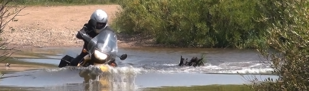
Then we happened upon our first water crossing. At the bottom of a hill I pulled up short. Not the best place to stop, but I couldn’t justify riding full throttle through a water feature where I couldn’t see the bottom. Remember my inaugural post?
Darrell and Piper pulled up next to me and we plumbed the depths by sticking long branches to see how deep the creek really was. The worst we found was about a foot deep so we made our decision to plow through and I handed over my camera to record the glory or embarrassment. Turns out glory was in our hands!
I splashed through with no problems until I started climbing up the opposite side. I made it to the bend in the road with high RPM, parked, and took over the camera. Darrell forded the stream next, then Piper (note how near perfect her technique is). Both of their rigs paused on the upward climb out and we had to push them up the hill a little ways before their clutches caught enough to make it to the top.
Now there are two schools of thought on going through water, demonstrated by Darrell and Piper. The proper way:
and the correct way:
Yep. She went so fast that I didn’t have time to capture the entire splash through. Note the scream of excitement, the timber in her voice as water soaks in everywhere. Brilliant. A group of ATVs and dirt bikes came around the bend and just ploughed through the stream throwing up a wall of water so tall that I’m surprised there is still a drought in Eastern Colorado. Oh well.
Once Piper and Darrell got their rigs up the hill, which required a sharp left turn over ruts, soft sand and rocks, I found I had gotten my rig stuck in 2 wheel drive. I tried the normal tricks to kick it out, but nothing worked so I rode up the hill with the sidecar wheel engaged. With a little more room at the top, we were able to pop it out of 2 wheel drive and I could continue riding normally.
It was right around this area that I would’ve started crying on my F650 GS. The road, with all its dips, and twists, changed into sand, then deep sand. My Ural Patrol slipped through the deepest of sand traps and I tried to find paths through that would be the best on the Beemer—paths that would be long gone by the time I returned. If I ever thought the Utah Backcountry Discovery Route had deep sand and silt, this took my issues to a new level (Please stand by. I’m sure I’ll blog about riding the CO BDR on two wheels toward the end of summer.)
Darrell’s clutch continued to act up so we rode straight for Buena Vista, got gas and headed up Cottonwood Pass. The sooner we got to the campground, the sooner Darrell could poke around to see if his clutch was fixable.
The eastern side of Cottonwood Pass is paved all the way up to the 12k foot summit, making it accessible to everyone. Cars that came up behind me passed when it was clear, despite the 35mph speed limit—which turned out to be perfect for my loaded down Ural. Darrell and Piper slowly dropped behind me (I had a lighter load). I pulled over at the summit to make sure there were still with me and to snap some photos.
Now it was all downhill from here. Literally. We forewent the rest of the Colorado BDR along our route and stuck to the main road in case the clutch completely failed on Darrell. But we got stuck behind a road grader, and despite snacking along the route on homemade beef jerky and granola bars, what I lacked was caffeine. I felt like I could doze off at any time, so I stood on the pegs, sang into my helmet, and kept myself alert until we pulled into our campground.
Craig and Julie had long since made it in, and when they offered coffee I felt an insurmountable joy that only the caffeine addicted can truly feel. Darrell tinkered with his rig and we (The “royal we” as I just sat and watched since I don’t really understand the clutch assembly) tightened bolts, tested the clutch and threw out all sorts of hypotheses we felt we could test in a campground without the luxury of a garage and all its tools.
I understand the frustration that comes with not being able to fix your bike on a ride. You want things to come off perfectly with issues that aren’t insurmountable. I feel it all the time when I fall over on my GS (I do it often enough), and with every piece I break, or which suddenly stops working and I have no idea why. With every odd sound I start to worry about what could be wrong and whether I can fix it on my own, or if will it be another expensive trip to the dealership. Fortunately I don’t have this problem with my Ural since 1. It is newer, and 2. I have yet to fall over on it.
The rest of the trip has been well documented by both Dom and Darrell, but to sum up, food was eaten, coffee drunk, hero’s made, and other characters rescue in only the most heroic of settings. With each year (okay, so there’s only been two) the CZAR gets better, and I can already tell you the games we have planned for 2014 should not be missed! Mark your calendars now!